i)
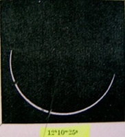
The Chronometer of the balloon "Globule" has been tuned on
Paris' Observatory by Paul TISSANDIER. It indicated
exactly
12:11:51,
when Auguste NICOLLEAU took the following the picture:
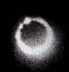
which
suggests that the position of the balloon was very closed to the center
line.
Its altitude was estimated to be 900 meters over the Bridge of Rethondes,
on the North bank of River Aisne, 100 meters West from the
bridge.
With Google Earth one can estimate this location to be:
E2.93697 / N49.41497,
i.e: with Xavier JUBIER
5MCSE
software with the
option &DdT=1 for
tuning on our Geo-Chronoligical Model,
http://xjubier.free.fr/site_pages/solar_eclipses/xSE_GoogleMapFull.php?Ecl=+19120417&Acc=2&Umb=1&Lmt=1&Mag=0&Lat=49.41497&Lng=2.93697&Elv=900.0&LC=1&Zoom=15&DdT=1
5MCSE
retrodicts the occurrence of the
maximum at
12:11:54,
a duration of 1.2
[s], and 51° for the height of the Sun
Let us note here that 5MCSE qualifies the eclipse over this site as
"annular", while
at
sites south of W3.0773 /
N45,45983 (i.e.: 150km off
Les sables
d'Olonne),
it is described as
"total",
ii)
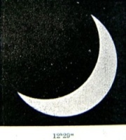
At the FLAMMARION
Observatory at Juvisy s/Orge
@ E2.37° / N 48.69°
the maximum given by 5MCSE
is at 12: 10: 19.with a magnitude of 0.992
C. FLAMMARION reported 12:10:20, as the time of the picture taken by F. QUENISSET
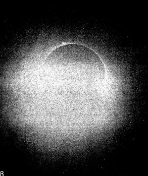
It is
of great interest: though slightly OFF centrality; protuberances were
visible:.
we will refer to this effect as FLAMMARION's
partial corona.
Concerning the timing of the maximum other pictures of
QUENISSET indicate
the occurrence of the maximum at about 12:10:15
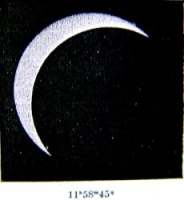
iii)
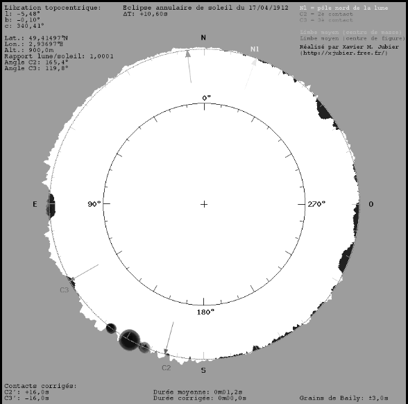
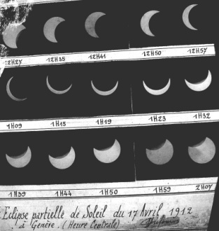
The totality of the pearled eclipse on
1912.04.17 has been photographed
at Saint-Nom-la-Bretêche, GPS E2.016°
/N48.857°, by
A. DANJON, at supposedly 12:09:53
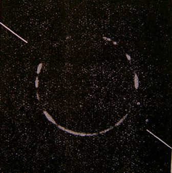
5MCSE retro-predicts for this site the maximum at 12:10:01 and a duration of 1.9 s.
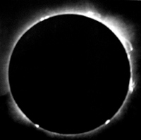
iv)
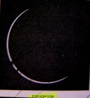
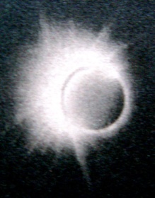
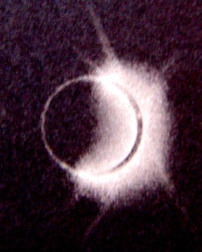
Another interesting picture of this pearled eclipse is:
v)
From a captive balloon, the size of the Lunar shadow on the Earth
has been estimated to be 3.5 km wide.
vi)
On 12 km of
the road between Neauphle et Trappes, 380 school children
have been spaced by 100 m to monitor the width of the
totality path
The central zone has been 4 km wide.
The minimum diameter of the Moon (bottom of the valleys) lasted 3 [s]
less than the one of the Sun, while the maximum diameter (mountain
peaks)
was surpassing by 2 [s]
the diameter of the Sun.
vii)
At the crossing of la Grand'Croix, N48.8006° / E1.9206 /
12:09:49UT
at presumably only 600 meters from the center line of the totality zone
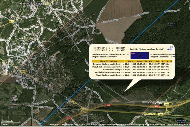
Léon GAUMONT
(1864-1946)

obtained a cinematographic
record of the event.

viii)
In
Ovar, observatory stations were spread along the road between Carregal to Cadaval
While
5MCSE retrodicts
only 1.4 km of
the road to
have been in the totality zone,
all
the observers who were spread
over 5 km to the West of station #10
have believed to be in the central line !!!
At station
#10, GPS W8.59757 / N40.85432
COSTA LOBO
obtained 158 images in 14 [s]
showing Baily grains,
whose 40
with the grains only in the areas opposed to the Sun.
The eclipse was therefore total
for a time laps of
4.4 [s],
only along the direction of the
Moon,
what confirms the film of
Léon GAUMONT.
It has been interpreted, as the relative speed of the Moon
to
the Earth is about 0.38 ["/s], i.e. 693 [m/s], as due to the shape of
the Moon:
a slight flattening along the axis of rotation,
The irregular
profile of the Moon shows indeed,
between valleys and peaks typically a 1["]
difference.
In his 5MCSE software, X. JUBIER introduced a correction
for lunar limbs.
Let us note though that
Serge KOUTCHMY has shown evidence for an "ovalisation"
(or polar lengthening) of the Solar Chromosphere,
which, in our opinion,
might well have also contributed to the direction dependant
totality effect
recorded in 1912
 of magnitude 0.889.